R1 mapping
R1 zoning in Ottawa allows to construct only single-family homes in defined areas. This type of exclusionary zoning occupies the land inside urban boundaries and impacts the provision of other more affordable types of housing for different needs and levels of income on the same size of the lot. Therefore, R1 is not feasible, outdated and does not serve actual community needs. Moreover, it promotes home ownership as a commodity instead of human rights for housing. It also contributes to urban spread while being unable to accommodate population targets and therefore have lots of implications for climate and general non-resiliency of the city to climate change events.
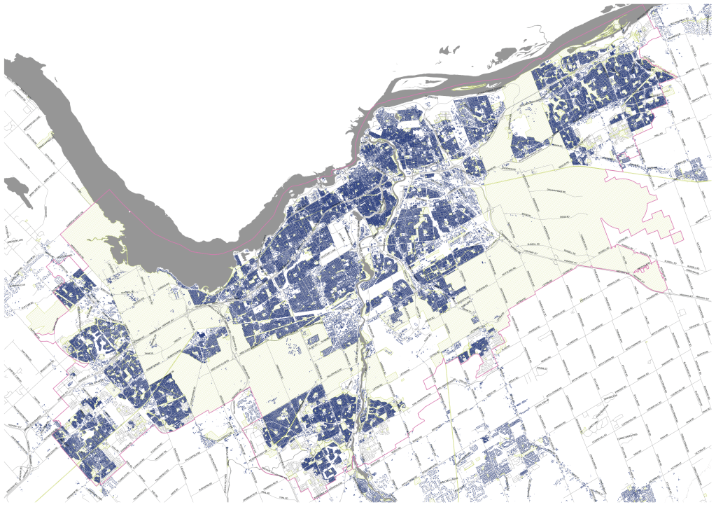
Being a single-use zone, commerce is not allowed on this type of land, contributing to car dependency. This type of zoning is not dense enough to be supported by active transportation and other types of mobility, except private cars. It also puts strain on infrastructure costs. The mapping shows a visual context of how much of the space in the urban boundary can be used more effectively. The lots within the R1 zone are usually bigger than for any type of development except the mid-rise and high-rise residential. Therefore, they carry a considerable potential for intensification while maintaining the existing housing stock of single-family homes. The data analyzed is buildings’ footprints as the zoning maps are not available as open data and are not shared by the Planning Department.
Ottawa’s urban boundary with all buildings footprints (as of June 2021).

Ottawa’s urban boundary with R1-zoned buildings footprints (as of June 2021).

Leave a comment